Monte Baldo - Baldovilla
Holiday Apartments in Malcesine
BaldoVilla


Main menu:
Monte Baldo
Things to see
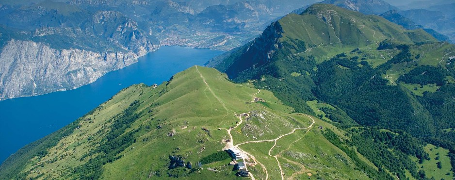
The Mount Baldo massif reaches a maximum height of 2,218 mt. MALS. It is situated between the provinces of Trento and Verona, lying between the municipalities of San Zeno di Montagna, Ala, Avio, Caprino Veronese, Ferrara di Monte Baldo, Brentonico, Nago–Torbole, Brenzone and Malcesine.
Its main mountain range has a north-south orientation, its natural borders are in the south the near Capino Veronese beginning plain, Lake Garda for 40 kilometres along the west side, in the north a valley joining Rovereto to Nago-Torbole, and Vallagrina on the east side.
The largest mountain chain consists in two parts, Mount Baldo and Mount Altissimo, which stands alone. Starting in the south, its peaks are Creste di Naole (1660 m), the mountain ridge of Costabella (2062 m), Coal Santo (2072 m), Vetta delle Buse (2154 m), Sascaga (2134 m), Punta Telegrafo (2200 m), Punta Pettorina (2191 m), Valdritta (2218 m), Longino (2180 m), Pozzette (2128 m), Dos della Colma (1830 m) and l’Altissimo (2078 m).
For info we suggest:
www.funiviedelbaldo.it
The Apartments | The Garden | Things to see | Things to do | Map | Info | Contact us | General Site Map